August 28, 2020, 14:30-16:00
Coordinator: Peder Gammeltoft
What would a workshop on ’Place-names as Open data’ contain?
- A conceptualisation of what is
Open Data (15 minutes presentation)
- Open data
- Linked open data
- Benefits of Open Data in place-name research? (15 minutes presentation)
- Discussion (45 minutes presentation)
- Conclusion (15 minutes presentation)
Possible elements in workshop presentations:
Explanation of what is Open Data?
Open data is the idea that data should be freely available to everyone to use and republish as they wish, without restrictions – or with only very minimal restrictions – from copyright, patents or other mechanisms of control. The goals of the open-source data movement are similar to movements such as open access, open-source software and open science, and the open web. The philosophy behind open data has gained popularity with the rise of the Internet and World Wide Web. However, the term linked data is also used of web-semantic linked data (when they are open, that is). In computing, linked data is data structured such a way that when interlinked with other data it becomes more useful through semantic queries. It builds upon standard Web technologies such as HTTP, RDF and URIs, but rather than using them to serve web pages only for human readers, it extends them to share information in a way that can be read automatically by computers.
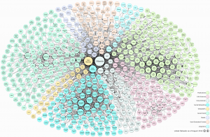
Linked open data enables the automatic combination of datasets with each other in interlinked networks, as the diagram showing Linked Open Data (LOD) datasets as of August 2014. The goal the linked open data movement is to extend the Web with a data commons by publishing various open datasets as RDF on the Web and by setting RDF links between data items from different data sources. Of famous LOD datasets we find DBpedia – data extracted from Wikipedia (about 3.5 million concepts described by 1 billion triples), and GeoNames – RDF descriptions of more than 7,500,000 place-name localities worldwide.
The vision of linked data is for the Internet to become a global database, first expressed by Tim Berners-Lee, director of the World Wide Web Consortium (W3C). He coined the term in a 2006 and outlined four principles of linked data in his, that can be describet in this way:
- Use URIs to name (identify) things.
- Use HTTP URIs so that these things can be looked up (interpreted, “dereferenced”).
- Provide useful information about what a name identifies when it’s looked up, using open standards such as RDF, SPARQL, etc.
- Refer to other things using their HTTP URI-based names when publishing data on the Web.
Are Open Data used in place-name research already?
Linked open data:
Geonames.org – https://www.geonames.org/ (7,5 million place-names in RDF)
Perpleio – https://peripleo.pelagios.org/ linked open data visualisation of ancient place-names
Nimisampo – https://nimisampo.fi/app A Finnish initiative for open data and open software for place-name datasets
Norske stedsnavn – https://toponymi.spraksamlingane.no/app A Norwegian application of the Finnish Nimisampo platform

